We really enjoyed Glacier even though our time there was marred by chilly, cloudy weather. The famous Going to the Sun Road was interesting, but more than anything else we enjoyed the hikes we did at the park.
Days 27-31
August 29 – September 2, 2014
Miles 3854 – 4235
Just before entering Glacier National Park for the first time we stopped to get sandwiches in West Glacier and planned to drive into the park to find a picnic area for lunch. We started our visit at the Apgar visitor center where there is also a shuttle bus that will take you into the park. We decided spur of the moment to wait for a shuttle instead of driving like we had planned. Also waiting for the shuttle was a solo traveler named Sam. Sam is a recent college graduate and writer who decided to see the country and is taking a journey to many of the same places we are. You can check out Sam’s blog at http://roadsicouldntname,wordpress.com for a more artistic prose of what traveling the country is like.
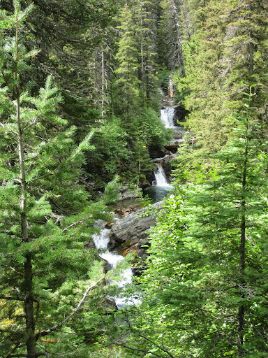
Sam invited us to hike to Avalanche Lake, so we ate our lunch and joined him for the 2 mile walk to the lake. The hike starts around Cedar Creek, which is a small creek that cuts an amazing canyon along the trailside. After 2 miles of walking through the forest we came to the Avalanche Lake. The lake is a beautiful hidden gem; nestled at the base of a horseshoe shaped mountain ridge. Small waterfalls run from the ridge down to the clear lake.

The hike starting at Cedar Creek Canyon

Two 2 miles through the trees

Avalanche Lake
After our hike Jon and I drove to the Whitefish Bike Retreat for the night. The Bike Retreat was a very cool hostel style lodge, with a large communal living room, kitchen, and firepit. We made ourselves at home and cooked spaghetti for dinner. We also chatted with several other travelers before turning in for the night.

Bike retreat, some hippie is doing yoga…. (it’s Alexis)
The next morning we got up early to get ready for another day in the park. It also happened to be the morning of a Penn State football game being played in Ireland (at 6:30am mountain time) so we watched one quarter while eating breakfast. We drove back to Glacier where we met up with Sam again to hike the Highline Trail.

Like the day before, the Highline Trail was amazing and I am very glad we met up with Sam because he picked some wonderful hikes which saved Jon and I our normal hours of researching what to do. Our day started by taking two shuttle buses (which took almost two hours including waiting time) up to Logan Pass. The hike leaves from Logan Pass and is along a thin trail cut and carved into the steep Garden Wall mountain side.

Us with Sam on the Highline Trail


The trail runs for 7.6 miles to the Granite Chalet where a very steep additional 4 miles brings you back down to the road. The views of the valley and adjacent mountains were beautiful. About an hour into our hike it got cloudy and rainy. We took cover with some other hikers in a few trees and were taunted by sunshine a few miles ahead on the path. Eventually we decided the weather coming our way was looking really bad and that we should make a run for the next curve where the sun was; so we sprinted along an exposed part of the mountain. While running the rain changed to hail pelting us! Luckily we did get ahead of the storm and were able to walk the rest of the way in better weather. Along the hike we passed a circle of large bigorn sheep and some mountain goats. When we finally reached the chalet we took a short break. Some hikers staying at the chalet had a telescope set up and let us watch a grizzly bear they had seen on a mountain top a few miles away. The last 4 miles were down the Loop Trail and were very hard on our legs and knees. We made it back to the shuttle bus stop just in time to catch one of the last buses of the night. After our hike Jon and I set up camp at Glacier Campground and then joined Sam again for dinner at the Glacier Grill and Pizza.
The next day in Glacier Jon and especially I were still sore. We decided to take it easy, drive the Going to the Sun Road, and research backcountry hiking options for the next day. We ate a late breakfast at the Backwoods Bistro and then drove into the park. The road which cuts through the park is called “Going to the Sun Road” and twists through the steep mountain passes very reminiscent of roads in Switzerland. The most interesting part of the road is the beautiful stone work bridges and arches which allow the many streams and waterfalls on the mountain to pass under the road. We stopped a few times to take pictures and once we even saw a bear eating berries on the side of the road.

A bridge in going to the sun road

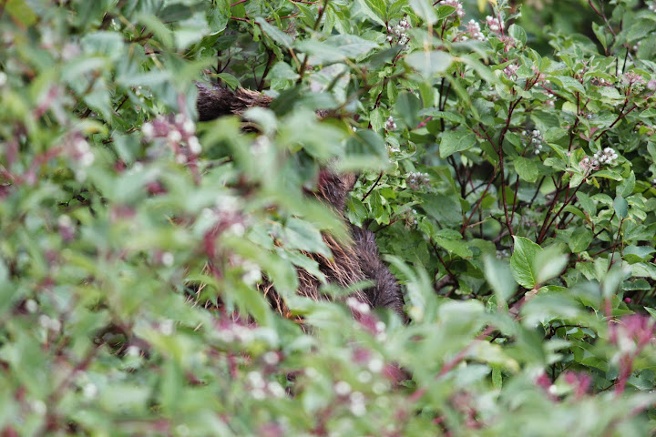
There is a bear in these bushes

St. Mary’s Lake
We eventually made it through the park to St. Mary’s where we went to the visitor’s center and spent an hour deciding on a backcountry hike to do the next night. Before leaving the park for the day, we drove to Many Glacier. The hikes at Many Glacier were long, so instead we did a quick 2.5 mile hike around Swiftcurrent Lake. After our hike we stopped in the park lodge very quickly and caught the last two songs of their traditional Sunday night hootenanny.

It was getting dark so we made our next priority finding a bed for a night. We inquired at one motel that seemed over priced, and drove past several campgrounds advertising ‘cabins’ which didn’t look promising until we found the Duck Lake Lodge. The man at front desk was very friendly and although the lodge was booked he gave us a deal on a cabin on the property. Staying the cabin was definitely a trip (think U shaped beds), but at least we got beds and heat for the night. We ate dinner at the lodge where the highlight of the meal was our conversation with the staff.

Duck Lake Lodge Cabin – Doesn’t look so bad in the day

At night
Monday was Labor Day and the start of our backcountry hike. We had picked a 5.2 mile hike to Otokomi Lake . It was still chilly and a bit rainy (I’m convinced it must always be cloudy in Glacier; the clouds just seem to hang over the tops of the mountains).

For me, the 5.2 mile hike up 1900 feet carrying my pack was the longest 5.2 miles ever. We did meet some friendly people on the trail, but it just kept going and going. Most of the hike is just above a small creek and you can see several nice waterfalls through the trees.
Waterfall along the Otokomi Lake Trail

At one point the trees clear and the last mile is along a stoney path on a desolate mountain side. The whole trail is through bear country and you must talk loudly and clap your hands so any bears nearby will slink away before you get there. When we finally got to the camp we found we were the only ones there for the night. The camp was nicely laid out with tent spots, a food area (with benches to sit on), and pit toilet. The first thing we did at camp was to hang our food from the food pole so bears wouldn’t get to it; then we set up our tent and took a walk to finally see Otokomi Lake.

Made it to Otokomi Lake!
The lake was pretty and we took a short walk around half of it. During our walk Jon swears a bear answered him when he was yelling before walking around a blind curve. At camp we cooked dinner and then got in the tent to avoid the very strong cold winds. Twice in the night we looked out of the tent for stars. The stars we saw where amazing but it was partly cloudy and the winds never let up.

In the tent. It was only freezing outside with strong winds.

It got sunny as we left Otokomi Lake
By morning the clouds were starting to break up and the winds were a bit less. We took another look at the lake, made breakfast, and packed up camp. The walk back to the car was much nicer with sunshine for most of it. After our hike we got sandwiches for lunch before driving across the park again on Going to the Sun Road for one last time before starting our two day trip to Seattle. For dinner we ate leftovers from lunch at a park on Flathead Lake. We drove as far as St. Regis, MT, which is just a large junction to route 90, and spent the night there at a hotel.
Avalanche Lake Trail

So happy not to be sick anymore

Avalanche Lake

Highline Trail


Bighorn Sheep
Otokomi Lake Trail


Selfie! I’m happy because I got to take my pack off (seen in the background of the photo)

Tallest falls of the hike


No bears are getting to our food

The walk back

We made it to the car and I needed to lay down for a bit.


Thanks for the shout, guys :). It was awesome hiking with friends!
LikeLike
Pingback: Our Top 10 American Hikes | Herr We Go
Pingback: Our Favorite National Parks | Herr We Go