I’ve always heard good things about Bryce, but still didn’t know what to expect. Bryce ended up being one of my favorite national parks. Hiking among the breathtaking hoodoos was one of the most amazing hikes of our trip.
Days 84 – 85
October 25 – October 26, 2014
Miles 9436 – 9772
The northern Arizona/ southern Utah area is rich with national parks, national monuments, and other beautiful sites. To travel to Bryce from the Grand Canyon you pass very close to the Vermillion Cliffs National Monument and to the Grand Staircase Escalante National Monument. The road also travels past Powell Lake where we stopped for a picnic lunch and to enjoy the view.
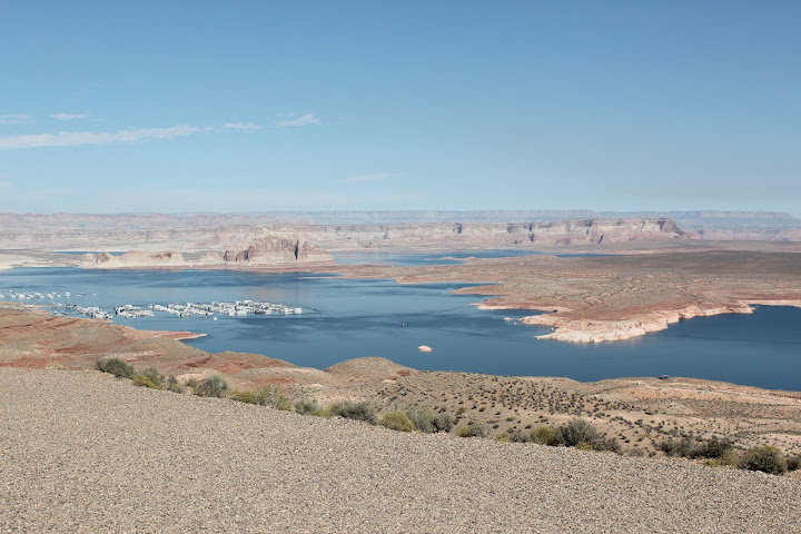
Lake Powell
Just before Bryce Canyon is scenic route 12 and the Red Canyon of Dixie National Forest. The dramatic red canyon really made a great first impression as we entered the region.
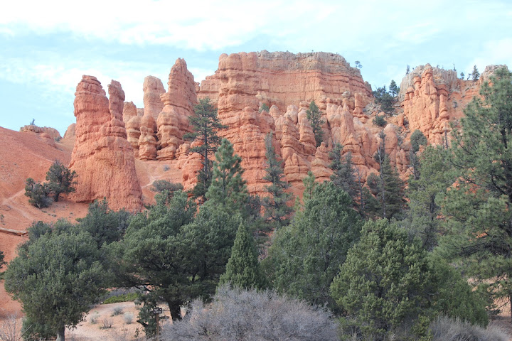
Red Canyon in Dixie National Forest
We arrived in Bryce Canyon National Park in the late afternoon and went straight to the visitor’s center before it closed. We watched the short film there and asked the rangers a few questions about upcoming ranger led talks. When we left, the sun was starting to set but we were eager to see the park so we drove to Sunset Point (named for its colors and not for its view at sunset).
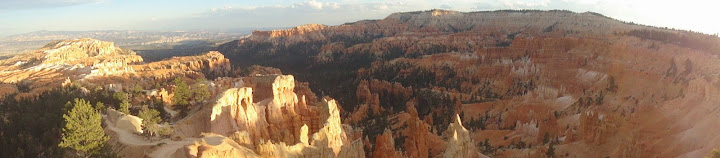

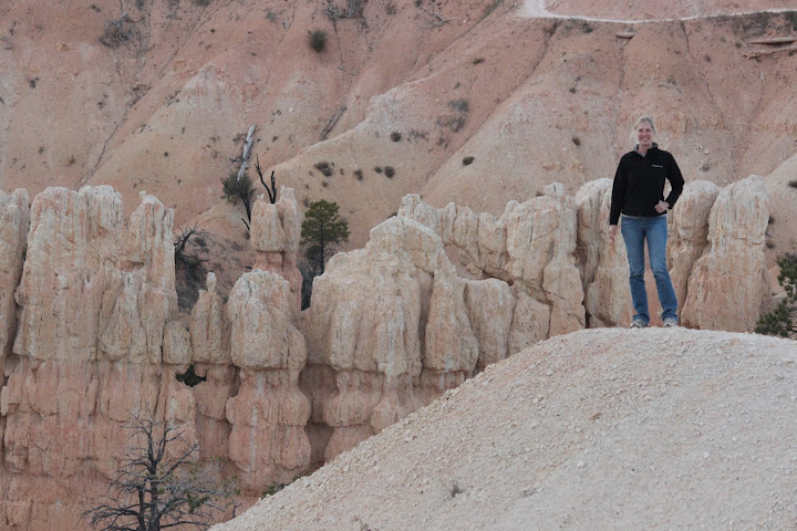
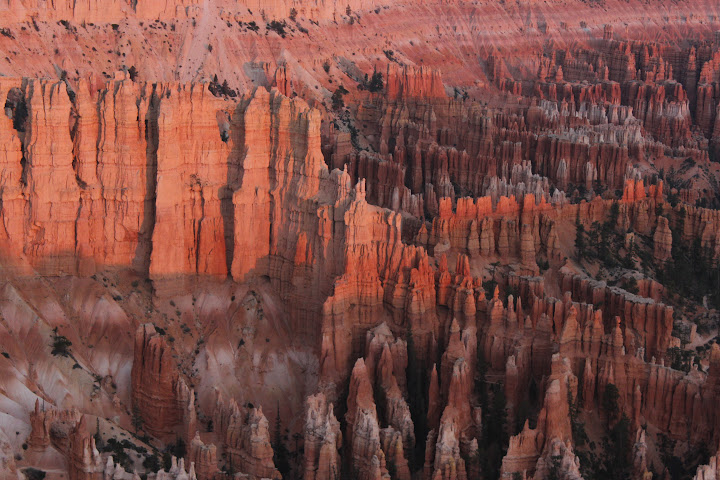
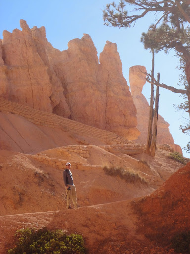
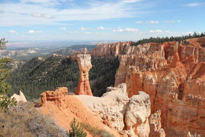
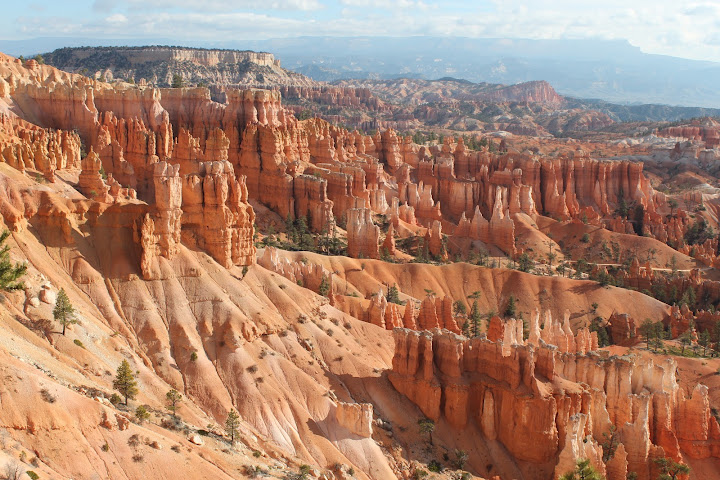
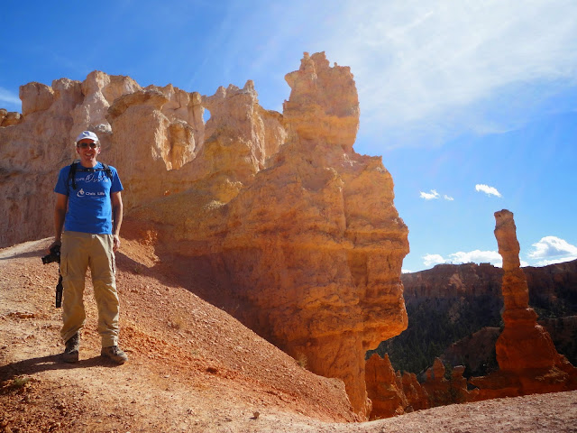
Bryce Canyon is famous for its hoodoos, towers of rock and stone created by erosion from rain and melting snow. A hard protective rock covering above some areas allows a column, the hoodoo, to remain standing while the earth around it is washed away.
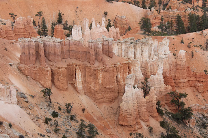
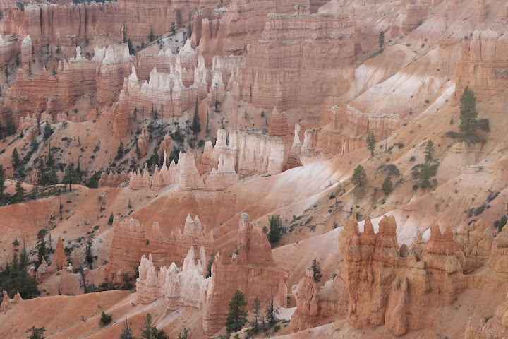

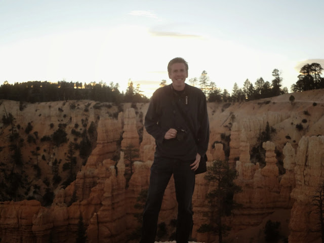
Our first look at the hoodoos was incredible. The closest thing Jon and I could think to compare the hoodoos to are the Badlands, although they are very much their own wonder. We walked along the rim of the canyon a bit in awe. Wanting to get a closer look, Jon and I ran out on a short flat trail to see the hoodoos close up.

Before leaving the park and while a small amount of light was still out, we drove to the Fairyland Overlook for another view of the hoodoos.

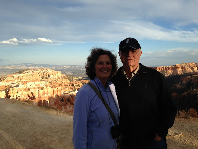
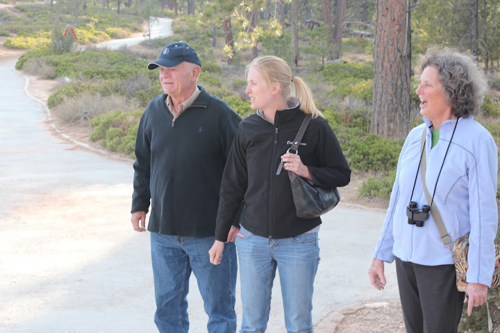
We stayed at Ruby’s Inn during our time in Bryce, where we had a room with a connecting door to my parent’s room. The hotel was actually very nice and only an included breakfast would have made it better. Ruby’s seems to own many of the establishments outside of the park. Being late in October we found that many places were already closed for the winter. Additionally, the park shuttle was no longer running. With most of town closed, there weren’t very many restaurants to choose from for dinner. We ended up eating at Foster’s Steakhouse. The food was good and the portions where huge at Fosters.
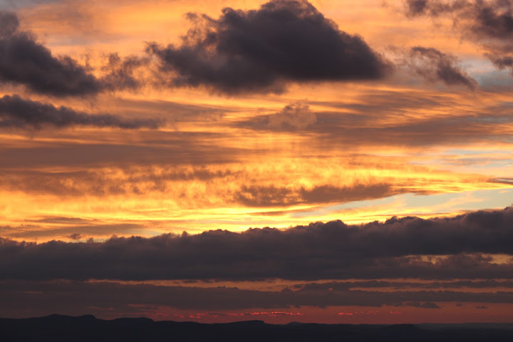
The next day, Jon and I woke up early to watch the sunrise over the canyon. Our guide book recommended that we watch the sunrise from Bryce Point. Apparently Bryce Point is no secret because we watched sunrise with about 6 serious photographers whose cameras and tripods took up the best part of the overlook, a dozen other people who had driven themselves to the overlook, and 100 tourists off of large tour buses. Since the canyon faces eastward, the sun does not rise over its rim. Instead, as the sun rises, it slowly lights up the canyon, bathing the hoodoos in hues of red. The morning was cloudy and so after a few minutes of light the sun would disappear behind clouds while everyone readied their cameras for its next appearance.

Cold and hungry, we went back to the hotel to join my parents for breakfast. Breakfast was not included with our rooms, but we ate at the hotel restaurant anyway. Once again we had huge portions of food.
Still excited to spend more time among the hoodoos, Jon and I separated from my parents for the day. My parents drove not only through the park, stopping at the overlooks, but also to the neighboring towns of Tropic and Panguitch. Jon and I set out on the 3 mile Queen’s Garden/ Navajo Loop trail. The trail starts at Sunrise Point. We parked at the trail end, Sunset Point, and walked to Sunrise. From Sunrise Point our trail dropped and twisted down the canyon and into the midst of the hoodoos. Early into the trail, Jon mentioned that he had heard that the Peekaboo Loop was also a good trail, but it seemed long and far off although we kept it in mind. Queens Garden was named for a particular hoodoo which resembles a statue of Queen Victoria. In the Queens Garden we also found a park ‘benchmark’ which said that if you find three benchmarks and tell the rangers you’d get a prize… game on!


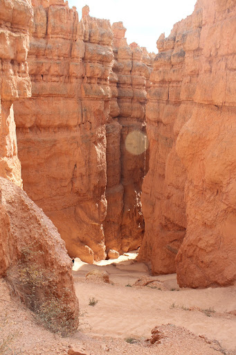
From the Queens Garden our route joined the Navajo trail. After a short distance the trail leaves the hoodoos to walk in the forest at the bottom of the canyon. When the trail curves back, it is at a big intersection of several trails. Slightly up one of the trails is ‘twin bridges’, two natural bridges formed between hoodoos.

Also at the intersection was benchmark 2. At this point we were just over halfway done with our 3.0 mile hike, however this intersection also had a spur that connected to the Peekaboo Trail. It was early, and we liked the hoodoos so we decided to start walking up the Peekaboo Trail. After climbing uphill, the peekaboo trail led us out of the forest and back into the hoodoos. As the hoodoos began to get closer and bigger to us we came across the Wall of Windows and benchmark 3.

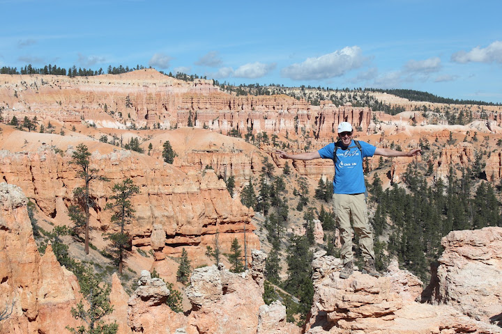
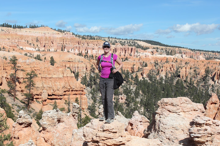
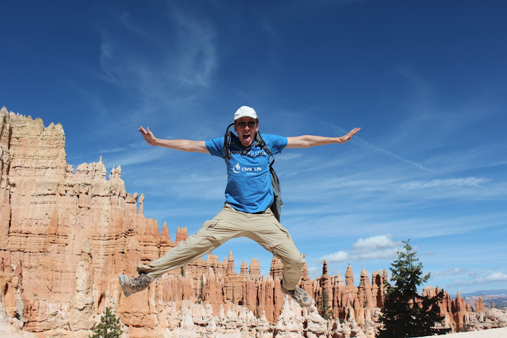
From the Wall of Windows we descended slightly and passed a horse trough and bathroom. From that point on, the hike got really good as we climbed back up into the hoodoos. At this point Jon called this hike the best so far and we took far too much time taking photographs of each turn and view. We also found a fourth benchmark. Completing the full Peekaboo loop left us back on the Navajo trail with over a mile more to walk. This last mile was called Wall Street and was a steep ascent back up to the canyon rim. Wall Street felt more like a traditional canyon with steep rock walls on each side of the trail, but was amazing none the less. We ended back at Sunset Point and our car. In total we ended up walking almost 6 miles on what is called the Figure 8 Combination, a combination of Queens Garden, Navajo Loop, and Peekaboo Loop. I think we were both very glad we took the time to walk the longer loop. Although a harder hike, the Peekaboo Loop had some great views of the hoodoos.

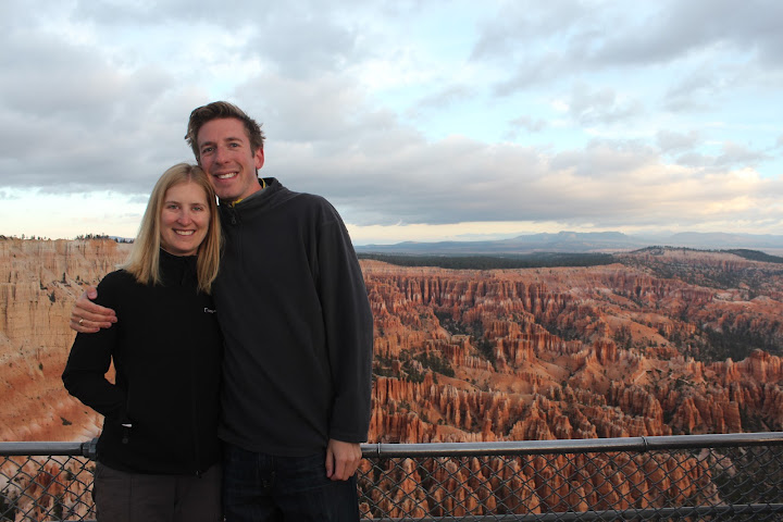
Knowing we still had a lot of park left to see, we got in the car and followed our guidebook to the other overlooks. The more notable overlooks for us were Natural Bridge and Rainbow Overlook. Additionally my mother told me later that Inspiration Point was her favorite (which was the only overlook we had skipped because we figured we saw its hoodoos from below on our hike).

Before leaving the park for the day we stopped at the visitor’s center to claim our prize for finding the benchmarks. We each got a pin engraved with the words ‘I hiked with the Hoodoos’ on it. I really enjoyed this little achievement and wish more parks had similar programs. We also got a free magnet by turning in a coupon in the park newspaper, another little perk that would be nice in other parks.
We went back to the hotel and considered swimming in the indoor pool. Instead, we ran into my parents and exchanged stories about the day. For dinner my parents took us to Clarke’s in Tropic. Clarke’s, like most of the area, shuts down for winter so they were out of several menu items. The food we did end up with was good and once again big portions abounded.
Also Try
- Vermilion Cliffs National Monument – Although I’m sure the views are beautiful here, Jon and I are most interested in one day hiking the ‘wave’ here. The wave, located in the Coyote Buttes area is a hike that requires a permit. Permits to hike the wave are awarded by lottery; some during a same day lottery and others in an advance lottery. We applied for and did not win the advance lottery. We will come back some day when we have a permit to hike the wave and see the rest of the monument then too,
- Grand Staircase Escalante National Monument – We saw some of this monument from the road, but it appeared to be better accessed by hiking in or by traveling on a dirt road from some length. In particular the Toadstool Trail looked like an interesting hike from the road.
- Antelope Canyon – A particular beautiful slot canyon on an indian reservation in the region. Private guided tours are available.
More Photographs
Pacellas on the move


Awesome! My husband and I visited Bryce Canyon on our honeymoon… what an incredible place!
LikeLike
Just found your blog, wanted to let you know that we use the same National Geographic guidebook and it has been a life saver when we show up at new parks without knowing what to do. From now on I’ll have to check your blog for tips at each park too.
LikeLike
Hi, it’s great to meet you! 🙂 Isn’t that book the best? We’ve used it for every trip, and it’s never disappointed us! Thank you so much for checking out our blog. I’m glad you like it!
LikeLike
Pingback: Our Top 10 American Hikes | Herr We Go
Pingback: Our Favorite National Parks | Herr We Go
Pingback: Petrified Forest National Park | Herr We Go
Pingback: Page, Arizona | Herr We Go