Stopping at coastal towns and beautiful views on our drive north to Sydney was sure a treat, but more time and better weather would have sweetened the deal.
Day 1 – Monday, March 23, 2015
It was time to move on from Geelong and head towards Sydney. We had decided that we wanted to take our time and drive between the two. Even though the drive can be made in 10 hours, we decided to give it 3 days. There are three possible routes to take between Melbourne and Sydney; along the coast, through the highlands, or by traveling through Cambria, the capital of Australia.
During our time in Sydney we talked to lots of Aussies and got many recommendations about which route to take and where to stop. Three days started to feel like it wouldn’t be enough time. We said goodbye to Lincon, stopped for a coffee, and headed out of Geelong towards Melbourne and the coastal route.
For most of the way to and through Melbourne the road was inland. We didn’t stop, and just kept going. For lunch we stopped in the town of Sale. Sale was small but had a few main streets with lots of cafes to choice between. We passed a few whose prices were expensive and ended up at a bakery. We had wraps and sandwiches which were large portions and perfect for us.
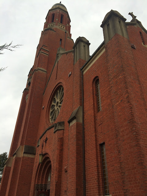
As we neared the coast and our destination of Lakes Entrance, we decided to stop at an information center. We were in Barnesville. The information center was very helpful and gave us tons of regional maps of areas we’d pass through on our drive. Before leaving, the volunteer helping us suggested we stop by the church next door saying we’d be pleasantly surprised. We took his advice and walked into St. Mary’s Catholic Church and its elaborately painted interior. As we entered a tour bus was pulling away from the church. The bus had had a guided tour of the church, and their guide was still inside and offered to show us around. We learned about the history of the church, its founder, and the painter responsible for the mural. The church was built in 1913 and was currently undergoing a restoration. The most interesting thing we learned were the stories behind some of the faces in the murals, which were based on real people in the small town.
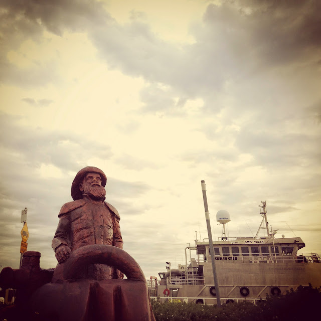
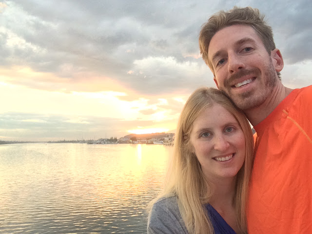
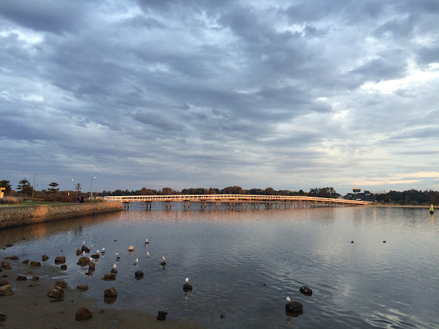
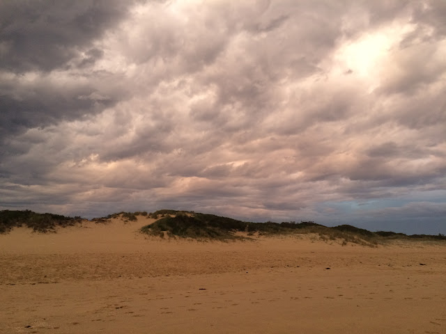
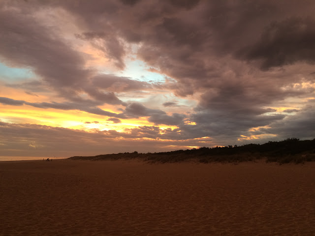
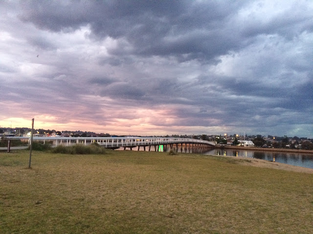
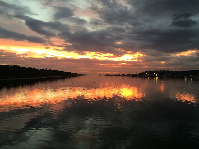
We finally made it to Lakes Entrance. We didn’t have a hotel, so we drove through town once and then checked into a hotel. After an hour of relaxing we decided to walk through the town. Lakes Entrance is built along an inter-coastal waterway and we decided to walk along the water. The town has carved wooden statues along the route we walked. We also stopped along the way to photo some large pelicans. Close to sunset we reached the pedestrian bridge which crosses the waterway. We walked across it and to the beach just in time for sunset and to see the clouds light up.
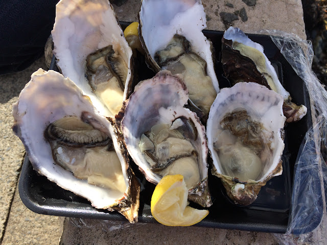
It turned dark quickly and we started to look for a dinner restaurant. Ferrymans was recommended on Trip Advisor and by our hotel, so we went there. Ferrymans is seafood served on a restored car ferry. We ordered a starter and split the seafood platter for one person. The platter was big and included salad, fish and chips, oysters, mussels, some scallop like food, a crab, fish fillets, mussels, and bugs. We had never head of bugs before; they looked like a cross between a crab and a lobster and you can eat the tail meat.
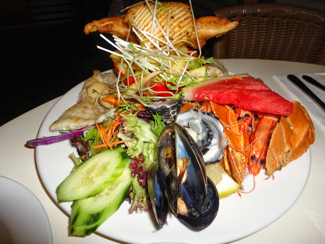

Half of a ‘bug’
Day 2 – Tuesday, March 24, 2015
We had hoped to start the day by waking up early, jogging on the beach to the Gippsland Lakes Entrance, and getting on the road early. Instead, we first saw a clock at 9am and hurried to check out of the hotel room on time. To save some money and time we stopped by a grocery store to buy fruit, muffins, cereal, and sandwich fixings for the next two days.
When we finally got on the road we had a pretty uneventful, one hour drive to Orbost. We had been advised to leave the main road at Orbost and take a detour along the cost to Marlo and Cape Conran. Orbost and Marlo are popular for being on the Snowy River, but it was too cold for water sports and we didn’t have the time anyway. Our detour was a bit disappointing, except for a few lack luster overlooks we couldn’t really see the ocean.
At Cape Conran, we drove into Cape Conran Coastal Park, parked the car, and did a short hike along the beach. At the start of our hike a large group of teenagers were dismounting from bikes and putting on wetsuits to go snorkeling. Apparently there is a large reef with great diving and snorkeling just off of the shore in Cape Conran. Our hike started on the beach, which was a bit smelly from decaying seaweed and covered in flies. The beach itself was very pretty with waves crashing over rocks. The path followed some wooden boardwalks and stairs along the beach. When the boardwalks ended we still had further to go along the beach although the path was gone. Eventually we reached a marked path away from the beach and took it inland and back to our car.
We continued our drive along the main road, A1, even though it was inland away from the coast. We bypassed the turn off for a historic lighthouse at Hicks Point because we read it would add 80 minutes to our drive. Instead we decided to tackle the 7km unpaved road into Croajingolong National Park and the start of the trail to Genoa Peak. The drive was bumpy and took a while. When we got to the trailhead of what we had heard was a 1.5km hike, we were surprised to see that the estimated time needed for the hike was 2 hours, which we didn’t have. We turned the car around and left on the same bumpy road. We also skipped visiting the town of Mallacoota although that had been on our original itinerary.
Finally we took a break for lunch in Eden. We drove to the very end of the road in Eden and ate near Lookout Point. Our map indicated there was a lighthouse at Lookout Point, but it seemed to be more of a radio tower type structure. Lookout Point also had a lot of information about whale watching, but we knew it was the wrong season for it.
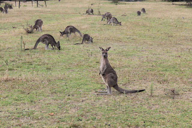
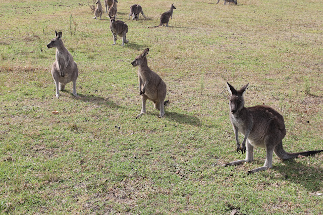
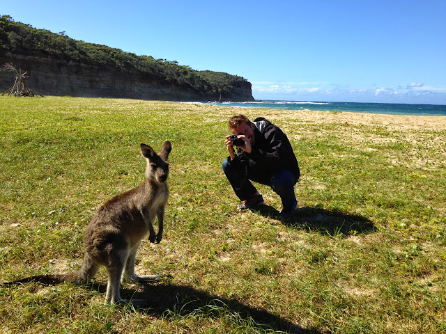
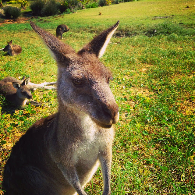
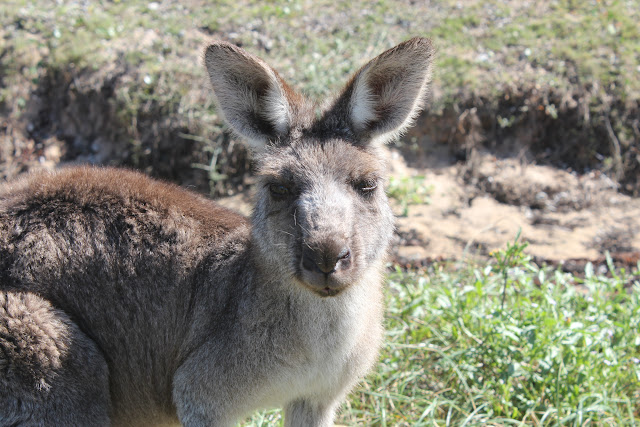
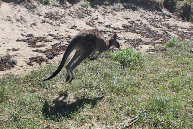
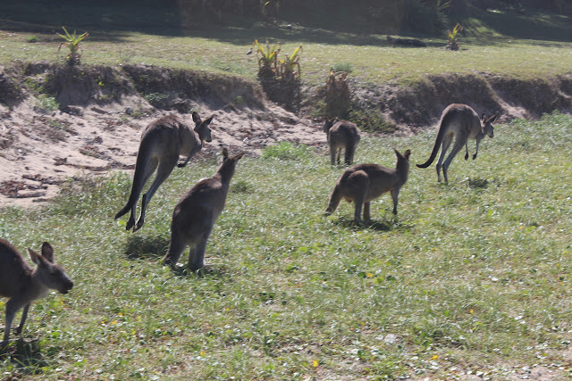
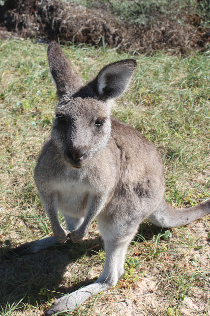
Next we pulled into Pambula Beach where we had been almost promised we would see wild kangaroos. We were told that they hang around the camping beach, but we didn’t even get that far before we passed an empty suburban lot filled with kangaroos. We parked our car to take photographs and were really excited to see a few hop around before we left.
The main road stayed inland and we didn’t take the time to drive to any of the many coastal towns we were near. Inland the road went straight through Bega and we stopped very briefly at the Bega Cheese Heritage Center. The center was in a barn type building. Upstairs were displays on making cheese and the history of dairying and a small crafts store. Downstairs was a cafe and information center. All we really did was try a few of the sample cheeses set out and continued along our way.
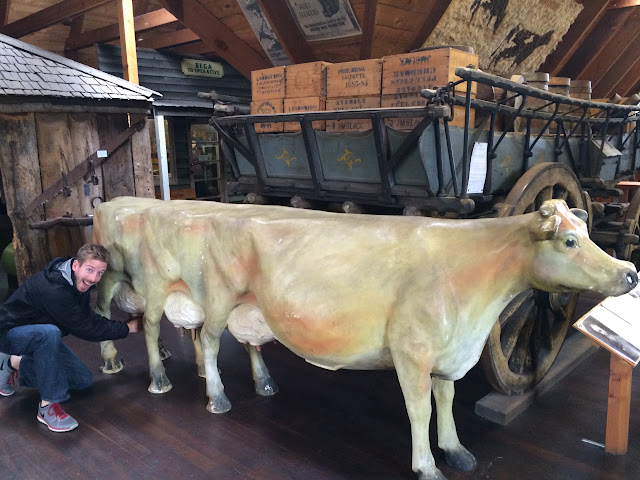
The only picture we took at the Bega Cheese Heritage Center was of this creep cow-centipede
The rest of the drive we listened to podcasts and then discussed them. The time went by quickly and we missed a few other possible stops that I had read about, such as Mumbulla Falls, Mystery Bay, and Camel Rock.
Near dusk we pulled into Batemans Bay and found a hotel for the night. We walked into town for dinner and ate at Kohlis Indian restaurant. The food was good, although the butter chicken wasn’t what I was expecting. After dinner our seemingly shy waiter started to talk to us and had much to say about moving to Australia from Chile and many of the local attractions. Mostly he told us where to find kangaroos and where to scuba dive to see sharks in the area. We also talked a bit about the huge fruit bats we had seen flying around on our way to the restaurant. He was very enthusiastic about Australia and genuinely happy to see tourists experiencing more than Sydney. He reinforced what we had been starting to figure out on our own; three days is not nearly enough time to properly explore the coastal cities. To really experience them as you should, you’d need the time for the hikes and day trips which we were passing up.
Day 3 – Wednesday, March 25, 2015
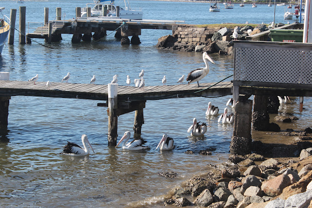
We woke up in Batemans Bay in no real hurry. We had most of the day to drive the remaining 3 hours to Sydney. Once again the grocery store was our first stop, then we drove down to Batemans Bay’s waterfront. Good weather makes a huge difference and the town was sunny with people out for breakfast. We walked along the water and enjoyed watching some huge pelicans.
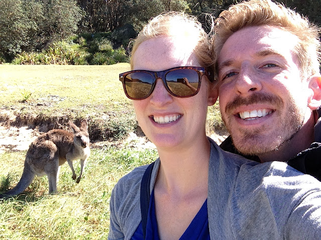
As we drove north along the coast, we stopped next at Pebbly Beach. Pebbly Beach is where our waiter the night before had recommended we go to see kangaroos. This was reinforced by a guidebook we had picked up about the area. Pebble Beach is in a campground, but when we were looking at the fees machine an employee cleaning up the area told us not to bother with it. The beach was pretty and mostly deserted. There were just a few people standing together at one side, but they were petting kangaroos! We walked over and took photographs of the kangaroos. A few times we got almost close enough to touch them, but nervousness and worry about the parasites we heard wild kangaroos have stopped us.
Jervis Bay was our next stop. We had been excited about Jervis Bay since some Aussies we met told us how they inadvertently spent 4 months there when they were meant to be traveling around the entire country. Jervis Bay isn’t a town, but instead is a bay with several small towns along it. We weren’t sure where to go, so we picked Huskisson because it was shown the largest on our map. We followed signs to an overlook and ended up in a small park. It was early afternoon so we sat down on a bench and ate sandwiches while seagulls gathered at our feet. It was a bit cloudy at the time, but we did see some people leaving on a dolphin watching cruise.
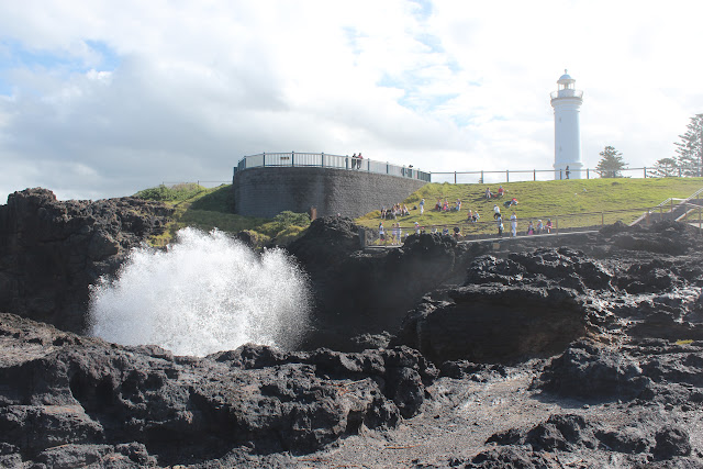
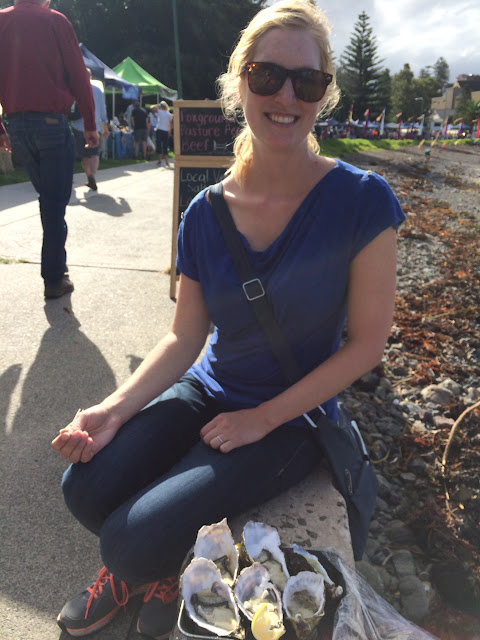
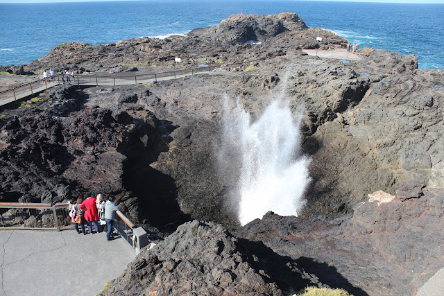
Kiama, further north along the coast, proved again how weather can improve a destination. We stopped at Kiama originally for no real reason except that Jon wanted a break from driving. The map showed a lighthouse and blowhole on a small peninsula at the end of town, so that is where we drove to. Just below the parking lot there were tents sent up, so I started by walking that way and found a small but nice farmers market. Most of the stands were produce, but a few sold ice cream, cider, and even oysters.
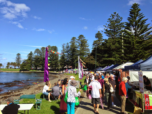
A walking trail led around the peninsula. To walk around the entire peninsula took about 30 minutes. At the highest point was a small, white lighthouse. Just below the lighthouse was a blowhole which would spray water high into the air. The blowhole was fun to watch, and I enjoyed the sounds of the water exploding and then raining down on the rocks. Sometimes there would be huge geysers of water one after another. Other times it seemed like nothing was happening at all. No matter how long we watched I couldn’t seem to notice a rhythm to the explosions. Further along the walking trail was a pool for swimming chiseled out of the rocky shoreline and filled with water. Before leaving Kiama we walked back to the farmers market and split a ½ dozen oysters. While we were eating a local reporter took our picture and our names.
Just a few miles from Kiama is Bombo Beach. We had seen a photograph of column like rock formations and wanted to stop. We didn’t have a local area map and only had a set of confusing directions. We ended up seeing the rocks, but from a distance. We knew time to get to Sydney was starting to run out so we didn’t bother to find our way closer.
Travel Information:
Cartoscope maps and travel guides were great help to us and work in conjunction with each other.
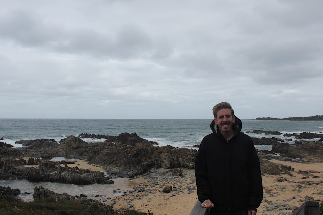
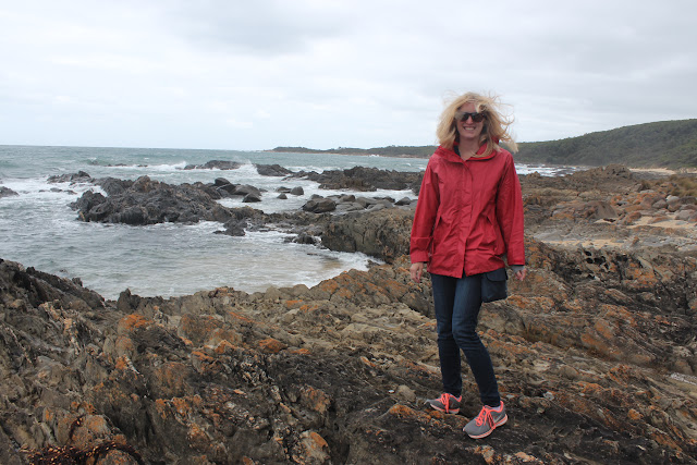
Additional Photographs:


Great photos. I would lobe to see kangaroos in wild. The coastal scenery is very pretty but brrrrr it does look cold. Finger crossed for more sunny days.
LikeLike
We had heard we would definitely be able to see wild kangaroos if we wanted, but it was still such a shock to see them. It was a lot of fun. Hopefully you’ll make it there and see them too!
LikeLiked by 1 person